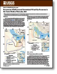
Using a geology-based assessment methodology, the U.S. Geological Survey estimated undiscovered, technically recoverable mean conventional resources of 13.3 billion barrels of oil and 111 trillion cubic feet of gas in the central Arabian Peninsula.
As part of a long-term cooperative program to monitor water quality within the Scituate Reservoir drainage area, the U.S. Geological Survey, in cooperation with Providence Water (formerly the Providence Water Supply Board), collected streamflow and water-quality data in tributaries to the Scituate Reservoir, Rhode Island. Streamflow and concentrations of chloride and sodium estimated from records…
The ability to rapidly disseminate scientific knowledge across the world has never been greater. This is paralleled by the ability of rumors to spread equally far and fast. Popular misconceptions can take root and, without correction, take on the appearance of facts. Commonly misunderstood topics include those with attention-grabbing phrasing (e.g. “Pacific Ring of Fire”, “supervolcanoes”, or “me…
Invasive hybridization between native and introduced species is widespread, especially in fishes, yet its effects on fitness-related traits across environments remain poorly understood. We combined individual genetic admixture estimates with capture–recapture data to quantify how hybridization between native Westslope Cutthroat Trout ( Oncorhynchus lewisi ) and invasive Rainbow Trout ( Oncorhynch…
Landslides pose a serious and ongoing threat to both human lives and infrastructure worldwide; therefore, it is of interest to predict where and when landslides are likely to occur. Advances in machine learning techniques have spurred numerous studies aimed at estimating relative landslide propensity, but are limited to spatial (as opposed to temporal) prediction due to the sparsity of landslide …
Understanding the drivers of nitrate export in rivers is critical for developing effective nutrient management strategies. However, few studies have explored event-scale drivers of export in large river basins with human modifications like reservoirs. Here, we analyzed nitrate concentration-discharge (C-Q) relationships from 215 events at the outlet of the Kansas River Basin, USA (155,690 km 2 ) …
Changing environmental conditions are increasing the frequency and severity of extreme weather and environmental hazards, including heat waves, wildfires, drought, reduced water quality, and degraded air quality from ozone (O3) and fine particulate matter pollution (AghaKouchak et al., 2020; Bolinger et al., 2024; Colorado Health Institute, 2023a; Fann et al., 2015; IPCC, 2023a; Nagamoto et al., …
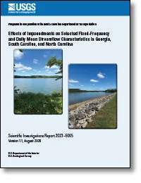
The U.S. Geological Survey (USGS) has a long history of working cooperatively with the South Carolina Department of Transportation to develop methods for estimating the magnitude and frequency of floods for rural and urban streams that have minimal to no regulation or tidal influence. As part of those previous investigations, flood-frequency estimates also have been generated for selected streamg…
Watershed sediment production is expected to increase in a warmer future with more extreme rain, with cascading effects throughout drainage and sediment-transport networks. This study investigated landscape-scale sediment movement in the eastern San Francisco Bay area, California, USA, during the extreme 2016–2017 wet season that brought major rainfall, landslides, and flooding. Mapping 8,928 lan…
Embedding datasets encode complex relationships among multiple sources of Earth observation data into a compact format. Here, we evaluated the utility of a 10-m global Satellite Embedding product (SE) for classifying crop types in central California for the year 2020. We compared the classification accuracy of a random forest model based exclusively on the SE layer to an existing random forest mo…
This study compares in vitro bioactivity profiles of extracts from private tapwater (51 samples), public tapwater (143 samples), and bottled water (31 samples), using high-throughput, multiplex, transcription factor screening. Of 48 biological end points tested, 25 showed significant (≥50% above the field blank) activity. Frequently detected (≥10% of samples) bioactivities (in decreasing order) i…
Low-temperature hydrothermal manganese oxides occur throughout the global oceans. However, the hydrothermal replacement of a carbonate ooze by manganese oxides is described here for the first time. The 24 samples dredged from three locations around the Territory of American Samoa in the South Pacific Ocean include six samples with remnant carbonate and volcaniclastic sediments, which we refer to …
Conservation science struggles with an ongoing divide between research and action. Given its history of broad public engagement and multi-scale management coordination, avian conservation typifies many of the challenges, successes, and opportunities across the broader field of conservation and is rich with examples that may guide solutions-oriented conservation science. In semi-structured focus g…
State and federal agencies are negotiating water-supply agreements that may govern water supply and storage in the Colorado River Basin through 2046. Current operating policies in the Colorado River primarily focus on water supply implications with less focus on the potential effects to other resources. Models that forecast the response of multiple resources over the short- and long-term term to …
The U.S. Geological Survey assessed the ability of metapopulation models to evaluate population-level effects of fish passage projects in the Upper Mississippi River for six native species: Ictalurus furcatus (Valenciennes in Cuvier and Valenciennes, 1840; blue catfish), Ictiobus cyprinellus (Valenciennes in Cuvier and Valenciennes, 1844; bigmouth buffalo), Acipenser fulvescens (Rafinesque, 1817;…
The U.S. Geological Survey (USGS), in cooperation with the city of Flagstaff, collected bathymetric, light detection and ranging (lidar), and land- survey data of Upper Lake Mary in Arizona during the months of April and October 2024. The city of Flagstaff uses a combination of groundwater from well fields throughout the Flagstaff area and surface water, mainly from Upper Lake Mary, for its potab…
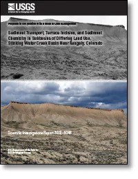
In many areas of western Colorado, Late Cretaceous Mancos Shale is a source of sediment, salinity, and selenium to surface water. Natural weathering processes and human activity can expose and move sediments from the Mancos Shale, leading to increased salinity and selenium concentrations in surface water. The U.S. Geological Survey, in cooperation with the Bureau of Land Management, studied four …
Mud Lake Dam, a rock and earth embankment structure, crosses an ephemeral stream that once flowed naturally into Carson Slough, the largest wetland complex in southern Nevada and a critical habitat for several threatened and endangered species. The dam was breached in the 1990s, rerouting stormwater into a new channel. The Bureau of Land Management and U.S. Fish and Wildlife Service are consideri…
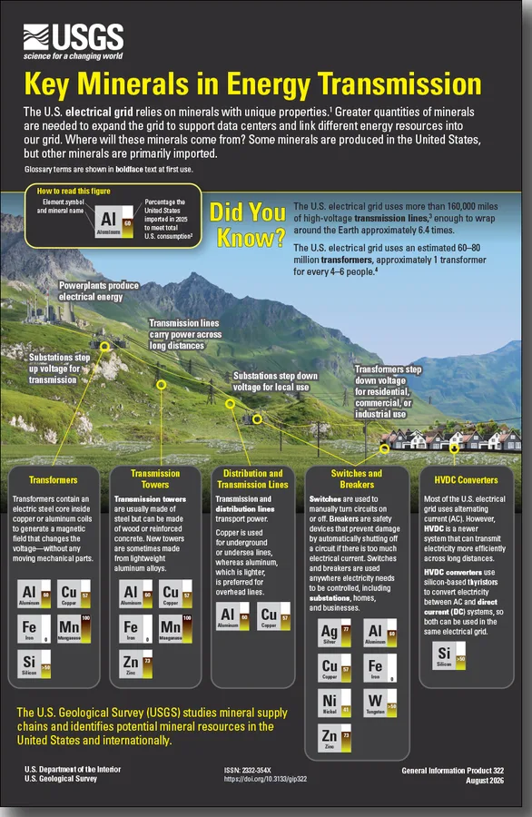
The electrical grid relies on minerals with unique properties to transform, transmit, and convert electricity. Transmission needs are growing—to support the expansion of data centers and link diverse energy resources into the grid. This expansion will require greater quantities of minerals. Although some minerals are produced in the United States, the United States relies on imports for others. T…
The spatial distribution of vents in a distributed volcanic field may provide clues about the geometry of the volcanic field’s plumbing system. Distributed volcanism is characterized by magma feeders that are independent of one another, scattered over wide areas, and active for relatively short times (typically less than one hundred years). On the other hand, focused volcanism results in large vo…
 research.io