Beneath the Arctic Ocean is an orchestra featuring natural and human composers, from cracking sea ice and whistling beluga whales to humming shipping-vessel engines. Researchers from MIT Lincoln Laboratory heard some of this cacophony when analyzing data from commercial off-the-shelf sensors that they integrated and deployed in 2024 during the U.S. Navy’s Operation Ice Camp […]
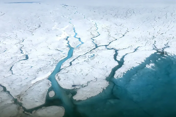
The retreat and acceleration of Greenland’s marine-terminating glaciers are linked to enhanced submarine melting driven by ocean warming. Despite the significance of these ice-ocean interactions, observations of ice-front proximal waters remain limited due to logistical challenges. Buoyant subglacial meltwater plumes entrain deep, warm Atlantic waters during their ascent. Using a plume model, we …
Nature Communications, Published online: 04 September 2026; doi:10.1038/s41467-026-77299-1 Instrumented elephant seals reveal that deep submesoscale motions are a ubiquitous and seasonally varying component of Southern Ocean circulation, with their intensity below the mixed layer closely tracking mesoscale eddy activity and supporting an eddy-driven origin.
A giant iceberg measuring more than 76 square kilometers broke from Greenland’s Petermann Glacier in August 2026, marking the Arctic’s largest glacier calving event since 2020. The berg later slammed into Joe Island but survived without breaking apart, and satellites are now tracking it as it drifts through Nares Strait.
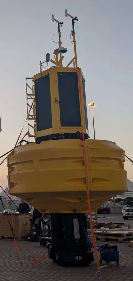
Ocean Scientific International Ltd (OSIL) has announced its 3.0m Marine Observation Buoy, a monitoring platform designed to provide early warning and surveillance for high-value maritime assets while supporting a wide range of oceanographic…
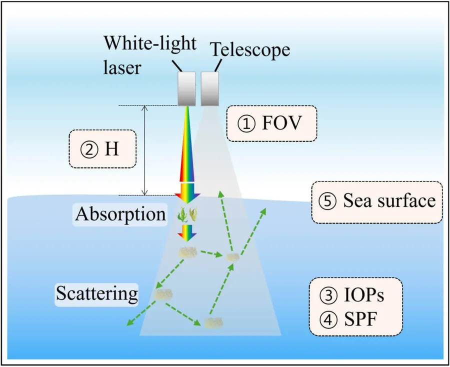
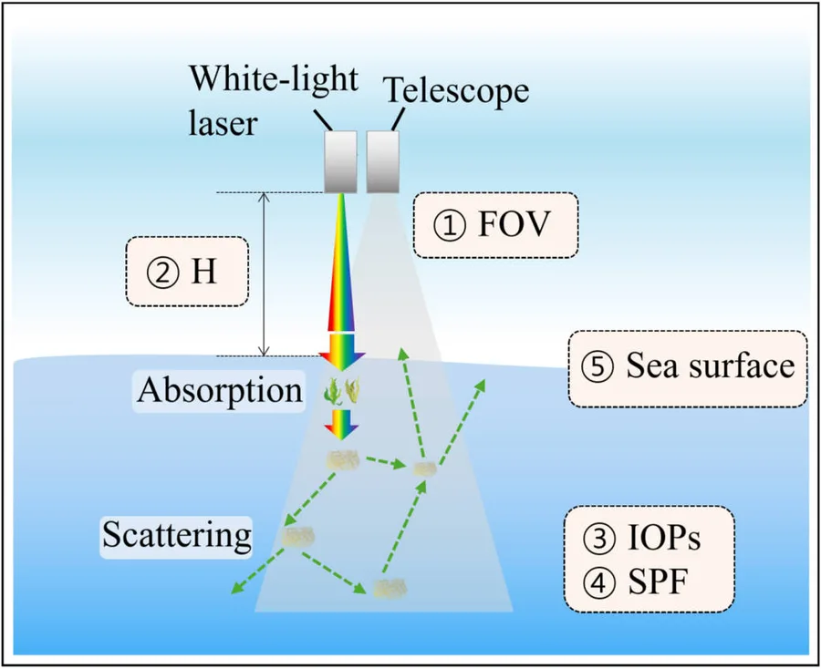
A white-light lidar concept could measure ocean remote-sensing reflectance (Rrs) without relying on sunlight. Simulations show that broadband laser pulses spanning 400-720 nanometers can reconstruct the spectral signal used to estimate aquatic optical properties. The approach could extend ocean-color observations under difficult illumination and provide a new reference for calibrating and validat…
A white-light lidar concept could measure ocean remote-sensing reflectance (Rrs) without relying on sunlight. Simulations show that broadband laser pulses spanning 400-720 nanometers can reconstruct the spectral signal used to estimate aquatic optical properties. The approach could extend ocean-color observations under difficult illumination and provide a new reference for calibrating and validat…
TDI-Brooks’ multi-use oceanographic research vessel, the R/V PROTEUS has completed its full-term ABS shipyard period in Las Palmas.During the shipyard period, TDI-Brooks expanded the vessel’s hydrographic capabilities and upgraded the PROTEUS…
Jose Carlos Borrero·...·University of Southern California
4d ago
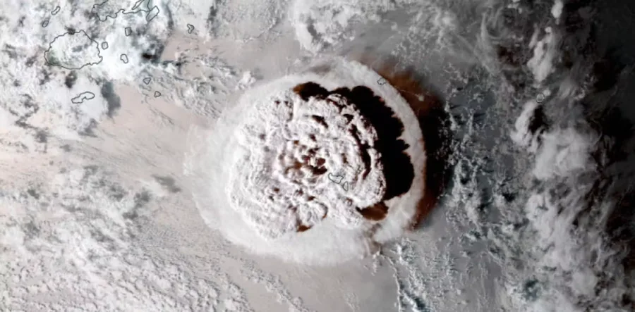
Underwater sound signals created by 2022’s enormous Hunga eruption have pointed scientists to a new way to warn people of unpredictable volcanic tsunamis.
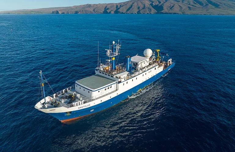
After 13 years with the same seafloor-mapping system, the research vessel Nautilus from the non-profit Ocean Exploration Trust (OET) is surveying the deep Pacific around Wake Atoll, a U.S. territory located about 3,000 miles east of the Philippines. The ship is now putting a newly installed multibeam sonar system to work at depths of up to 11,000 meters (36,089 feet), approximately 6.8 miles and …
Melinda Webster, a research scientist at the UW’s Applied Physics Laboratory, is the lead author on a new study that catalogs changes in Arctic and Antarctic sea ice over the past 50-plus years. She spoke with UW News about the story behind the numbers.
A.17 Hydrosphere solicits research on the Earth’s Hydrosphere: to advance the understanding of the physics of Earth’s water across the ocean, land, and the atmosphere. This Hydrosphere element is composed of three Earth science disciplines: ocean physics, terrestrial hydrology, and precipitation science. The overlapping goals of are to address fundamental questions about the distribution, movemen…
Nature, Published online: 28 August 2026; doi:10.1038/d41586-026-02747-3 El Niño events have been powering up since the Industrial Revolution. Plus, a visit to the Robot Olympics and an introduction to the Nancy Grace Roman Space Telescope.
Turning 29k home weather stations and Gemini AI agents into a 15-minute volcanic warning shield Published Paper : Capturing Volcanic Lamb Waves and Blast Yields with Netatmo Weather Networks (ESS Open Archive) Abstract Explosive volcanic eruptions generate powerful atmospheric Lamb waves—acoustic-gravity waves trapped in the planetary boundary layer that travel horizontally across the globe at so…




 research.io